
Interesting in Hiking a Guatemala Volcano. Here is the list with details.
Hiking a Guatemala Volcano
These are among the most prominent hiking destinations, and other lesser-known volcanoes also offer hiking opportunities. The exact number of volcanoes suitable for hiking can vary based on factors like accessibility, safety, and activity status.
Historically, these volcanoes have been central to the region’s geography and culture, and they continue to attract both local and international hikers.
The most hiked volcano in Guatemala is Volcán Pacaya. This volcano is popular due to its accessibility, moderate hiking difficulty, and the unique experience it offers with its active status. Here are some key points that make Volcán Pacaya the most hiked:
-
Accessibility: Located near Guatemala City and Antigua, Pacaya is easily reachable, making it a convenient day trip for tourists and locals alike.
-
Moderate Difficulty: The hike to the summit is relatively short and less strenuous compared to other volcanoes in the country, making it suitable for a wide range of hikers, including families and those with less hiking experience.
-
Active Status: Pacaya is an active volcano, and hikers often have the opportunity to see flowing lava, and fumaroles, and experience the warmth of the volcanic rocks. This adds an element of excitement and uniqueness to the hike.
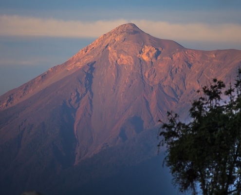
in Antigua Guatemala-Volcan de Fuego
Due to these factors, Volcán Pacaya remains the most popular hiking destination among Guatemala’s many volcanoes.
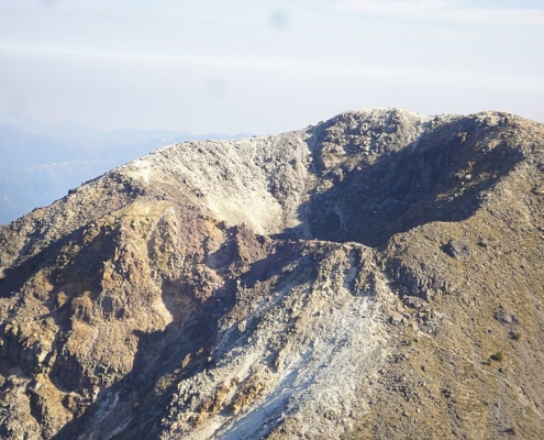
The hardest volcano to hike in Guatemala is Volcán Tajumulco. This is due to several factors:
-
Altitude: At 4,220 meters (13,845 feet), Volcán Tajumulco is the highest peak in Central America. The high altitude can cause altitude sickness, which makes the hike more challenging.
-
Length and Terrain: The trail to the summit is long and includes steep, rugged terrain. The ascent can be physically demanding, requiring good stamina and strength.
-
Weather Conditions: Weather in Tajumulco can be unpredictable and harsh, with cold temperatures, strong winds, and fog being common at higher elevations. This adds to the difficulty of the hike.
-
Remote Location: Tajumulco is located in the western part of Guatemala, in the department of San Marcos. Reaching the trailhead often involves long travel times and possibly multiple modes of transportation, which can be exhausting even before starting the hike.
These factors combined make Volcán Tajumulco the most challenging volcano to hike in Guatemala. However, the reward of reaching the highest point in Central America with its breathtaking views is a significant draw for experienced hikers and adventure enthusiasts.
Here’s why Acatenango is often deemed the toughest:
-
Altitude and Elevation Gain: Acatenango stands at 3,976 meters (13,045 feet), and the hike involves a significant elevation gain, typically starting from around 1,500 meters (4,921 feet). The steep ascent is physically demanding.
-
Length and Duration: The hike to the summit usually takes between 6 to 8 hours, depending on the pace and starting point. Many hikers opt for an overnight hike, camping near the summit to witness the sunrise and the active eruptions of neighboring Volcán de Fuego.
-
Terrain: The trail covers diverse and challenging terrain, including dense forest, volcanic ash, and loose gravel. The final ascent is particularly strenuous due to the loose, slippery volcanic rocks and sand.
-
Weather Conditions: The weather can be unpredictable and extreme, with cold temperatures, especially at night, strong winds, and occasional rain. Proper gear and preparation are essential to handle these conditions.
-
Physical and Mental Challenge: The combination of high altitude, steep and long trail, and harsh weather conditions makes the hike physically and mentally demanding. It requires good physical fitness, stamina, and mental determination.
The reward for completing the Acatenango hike is immense, offering breathtaking views of the active Volcán de Fuego and the surrounding landscape, making it a popular yet challenging adventure for avid hikers.
Guatemala is known for its numerous volcanoes, many of which are popular hiking destinations. There are around 37 volcanoes in Guatemala, though not all are suitable or commonly used for hiking. Here are some of the most notable hiking volcanoes:
-
Volcán de Agua: Located near Antigua, it stands at 3,760 meters (12,340 feet).
-
Volcán de Acatenango: One of the most popular hiking spots, with a height of 3,976 meters (13,045 feet). It offers views of the nearby Volcán de Fuego.
-
Volcán de Fuego: At 3,763 meters (12,346 feet), it is active and often viewed from Acatenango.
-
Volcán Pacaya: An accessible and active volcano, popular for day hikes, standing at 2,552 meters (8,373 feet).
-
Volcán Santa María: Near Quetzaltenango, it rises to 3,772 meters (12,375 feet) and offers views of the Santiaguito lava dome.
-
Volcán Tajumulco: The highest peak in Central America at 4,220 meters (13,845 feet), it is a favorite among hikers.
-
Volcán San Pedro: Overlooking Lake Atitlán, it stands at 3,020 meters (9,908 feet).
-
Volcán Atitlán: Another volcano near Lake Atitlán, with a height of 3,537 meters (11,604 feet).’
Hiking a Guatemala Volcano
 Ethical Fashion Guatemala
 Ethical Fashion Guatemala